5.27.2008

Wetlands

I have always had a fascination with swamps and cypress trees. Some of the best wetland shots are right off of the side of the road. The next three photos were taken from the side of a highway.


This shot and the one below it was taken from highway 70 near the Galloway exit just east of N. Little Rock Arkansas


I actually posted this one last October but since I was on the subject of things that are swampy I thought I would show it again. This is a Tupelo Swamp off of highway 165 in the town of Humnoke Arkansas.

This is not the best picture in the world but the subject is interesting. This is a Champion Tree and the largest Cypress tree in the state of Arkansas. It is also the largest tree in 40 of the 50 states in America. This tree is located in the White River National Wildlife Refuge in East Arkansas. It measures 120' tall with a circumference of 43 feet. A Champion Tree is the largest tree of a species in the state. The Arkansas Forestry Commission keeps a list of our Champion Trees. This list shows the species, the size and where the tree is located. There is even a link to the national champion tree list.

5.18.2008

Tim Ernst

I finally did it! I attended my first photography workshop with Tim Ernst. Tim has been teaching workshops for years. He lives in a cabin (Cloudland) on Cave Mountain Rd. near Boxley Arkansas. On his property he has recently built the Buffalo River Gallery to display his work. This gallery is open by appointment only but it is also where he teaches the processing part of his workshops.

There were six students (counting me) in Saturday's class. We met at 6 am in Ponca. I left home at 2:00 am to get there. Tim gathered us around his vehicle while he went over some preliminary information then we set off for Steel Creek to shoot Roark Bluff. Each of us did our own thing, moving from spot to spot and shooting away. Tim would come by and check on each of us at different times and offer advice and recommendations. We shot until the sun burned through the fog which was close to 9:30. Then, we all followed Tim in a convoy for a 30 minute drive to Cloudland. The last 7 1/2 miles of the drive is on a dirt road. The first mile or so is very steep uphill and curvy. The last mile or so is very bumpy and rough. Despite that it was well worth the drive. Tim's cabin is on the edge of a bluff overlooking the wilderness and the Buffalo River far below.

Whe we arrived, he took us on a tour of the cabin and we met his wife Pam. Pam is a very important part of the workshop. She cooks the lunch. Today's menu was barbeque beef, pork and chicken, barbeque beans, potato salad, chips and drink. Not only did she prepare the lunch but she also baked fresh piping hot chocolate cookies for an afternoon snack. We actually started the processing part of the worksop before lunch but it wasn't long before her voice proclaimed on the telecom system that lunch was ready. We all scurried from the Gallery building back up to the cabin and ate our lunch out on the deck. After lunch we went back to work and actually did not finish until 6:00. My classmates were from Houston Texas, Iowa, Pea Ridge Arkansas, Springdale Arkansas, and Pocola Oklahoma. I learned a lot in this class. It was worth EVERY penny I paid to take it. In fact, I am signing up for a two day workshop that he is teaching next spring. I HIGHLY recommend his workshop to anyone that is serious about photography and wants to improve the quality of the images they take and the quality of the prints that are made. Tim's website is http://www.cloudland.net/. His site is also a link on my blog.

The following are just a few of the photos from the workshop.


Tim Ernst
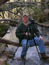
Tim working with one of my classmates.
The Buffalo River and Roark Bluff in the fog.
Roark Bluff and a rock reflection.
Rocks on the shoreline.
The view from Tim's deck.
Another view from his deck.


5.04.2008

Village Creek State Park

My latest adventure took place at Village Creek State Park near Wynne Arkansas. This park is located on Crowley's Ridge. Melissa was with me on this hike and so was my nephew Tommy. This was his first hike with us and he did great. We did a combination of trails that totaled 6 miles in all. The majority of the trail was in the woods but there were two overlooks and two lakes along the way that offered different views. The weather was great (Mostly Sunny and 70's).
Lake Dunn. This is where we began our hike.

Blue Phlox along the trail.

Danger, Danger...Melissa must hang on for her life. It's at least a 2' fall if she slips. :)

This is an interesting part of the trail. Not only because of the unique scenery, but it is also part of the "Trail of Tears" This trail was used as the Cherokee Indians were removed from thier homelands in southeastern United States to Indian Territory in present day Oklahoma from 1838 to 1839.

The trees on the edge of this trail were very interesting. Years of erosion put them on the edge but not to be out-done they just shoot roots to the next available soil.

This is Lake Austell from an overlook along the way.
Melissa and Tommy take a break.

The Tulip Poplar Tree is another thing that Village Creek is famous for. These trees are found throughout the park and the blooms are beautiful. They bloom from April to May.
After our hike, were driving out of the park when we noticed a lot of people and cars in the camping area. We drove over to find out what was going on. As luck would have it, we had stumbled up on "Pickin in the Park". This festival is held here every year and it features professional and amateur musicians. Different groups set up in various areas and play. Spectators just walk from group to group and plop down in their lawn chairs and listen. It was a nice and unexpected treat.


4.27.2008

Cedar Falls

Yesterday, I went back to visit one of my favorite waterfalls. It's Cedar Falls at Petit Jean State Park. This was my 3rd visit to this waterfall and each time has been at a different water level. The weather was perfect and the trail was crowded. I went late in the day so as the sun went down the crowd left and I was alone to shoot at will. This fall is 95' tall and when the water is up the roar is deafening. It is a 1 mile hike to the fall and of course 1 mile back. The last 1/2 mile coming back is a steep climb (whew) but it's well worth the effort.


I turned to look downstream from the fall and saw this awesome scene of the water reflecting color off of the tree canopy.


Another shot downstream

As I said earlier, this was my third trip to this waterfall. I thought you might want to see how it looked during my previous visits. So...here you go.

March 11, 2007 My brother was with me on this trip.

December 31, 2006 Melissa was on this New Years Eve hike with me.


4.14.2008

Waterfalls, Waterfalls, Waterfalls!!!

One benefit of all the rain we have had recently is getting to chase waterfalls. Melissa and I sat out on such a chase this past weekend. Melissa decided she was going to pick the falls we visited this time and she did a great job. The weather was sunny so we waited until afternoon to visit the falls. The sun was dropping behind the hills and the light was getting better as the day went on. In fact it was near dark when we left the last one. There are a few pictures below and I'll describe them as I go.

The first two photos were actually taken on Friday. Melissa was not with me. I had to make a north Arkansas run for work so I stopped by this fall on the way back home. It was very sunny and I didn't have my tripod. I had to use a fast shutter speed which freezes the motion of the water. This is the Hammerschmidt Falls. It is named after former Arkansas Congressman John Paul Hammerschmidt. He helped pass legislation that created our first national river. The fall is located off of highway 74 between Jasper and Ponca Arkansas. It is 43' tall.


The first stop for Melissa and me was the High Bank Twin Falls. It is located north of Ozark Arkansas off of highway 215. This fall is part of a creek that runs into the Mulberry River. There is no marked trail but it is easy to find by just following the creek upstream. These falls are 71' tall. Melissa is in one of the pictures to show just how tall they are. Melissa posed for me in front of the falls. I also included a cascade shot from downstream.


There is another creek that enters from the right as you are following the first creek to the High Twins. We looked and there was another fall that we didn't know was going to be there. We ventured up to it and it was beautiful. We decided to name this Sweet Melissa Falls. Melissa is going to do some research to see if it has already been named. If not, then we are going to see if we can officially name it. Speaking of Sweet Melissa, she is posing next to her own waterfall.


It was time to leave and go in search of two more falls. The falls that were next on our list were the Senyard Falls (29' tall) and the Murray Falls (37' tall). They are named after Roy Senyard (a volunteer maintenance coordinator for the Ozark Highlands Trail) and Dick Murray (a pioneer for hiking in Arkansas). These falls are located off of highway 23 (the pig trail) north of Cass Arkansas. There is no official trail to these falls and the terrain is very very steep. On the way down we passed what appeared to be a 70's model car whose driver more than likely missed a curve high above on the highway. One thing I always keep in mind is the farther we go down....the farther it is back up. Let me tell ya...some of the trip back out was on our hands and knees. One slip and I would have been an out of control boulder careening over a distant ledge to take up permanent residence next to...well... a 70's model car.

Anyway, back to the falls. To get in position to take the next pictures we had to walk above and around Murray and over, around, and below Senyard. The first picture below is actually a cascade above Senyard. Melissa is standing by the Senyard Falls. It was getting late as we wrapped up this trip and I was ready to head back to the truck with my trusty GPS in hand.


In case anyone was wondering how I find these falls and know the information I know about them....the answer is not that I am related to Lewis and Clark or a modern day Grizzly Adams...No, I must give all of the credit to Tim Ernst. You will notice I have a link to his website on this blog. The book below holds all of the secret hiding places and interesting tidbits about Arkansas Waterfalls. Tim has named several of the falls in our state. This book can be purchased from his website cloudland.net. I am taking one of his photography workshops on location in the Ozarks in May. I CAN"T WAIT!!!


On our way back to the truck we passed this makeshift shelter that someone built under a cliff side. Apparently someone was trying to slow down any bear that might try and wander in to camp in the night. Speaking of bears, it's getting dark, and I don't think I can out run Melissa. I am outta here.


4.13.2008

Spring has sprung

The wilderness is alive and kicking. Wildflowers are everywhere, the fields are green, the Buffalo River is roaring and the Dogwoods are blooming. What else could you ask for? I took these pictures during a drive through Boxley Valley in Arkansas' Newton County.


Water Water Everywhere

Needless to say, we have had more than our share of rain in the last few weeks. I thought I would post a few pics to let you see how it has effected the runoff at the dams.

Remmel Dam at Lake Catherine


Cooks Landing in N. Little Rock