The 683 acre Kings River Natural Area is managed by the Arkansas Natural Heritage Commission. This is an easy trail measuring only about a 1.4 mile round trip. It is fairly level most of the way and on part of it you will follow alongside the Kings River. It is located North of the community of Boston Arkansas which is located on highway 16 between Pettigrew and Red Star.
This is a feeder creek flowing in from the west. You could spend several hours exploring this area.
Up river from the waterfall.
Not a good picture at all but I wanted to show the mountain azaleas that filled the air with the smell of spring.
In recent weeks, the entire state of Arkansas has received several inches of rain. Everywhere you turn things are lush and green. There has been flooding in some areas including farmland which is delaying farmers from planting their crops. One silver lining to all of the rainfall is the waterfall activity that it leaves behind. All over the Ozarks and the Ouachitas the waterfalls are flowing well which makes it difficult deciding which ones to photograph with limited time.
On this day I chose Pam's Grotto Falls. This waterfall is located approximately 22 miles north of Lamar Arkansas off of highway 123. There is a small parking area on the right side of the highway about 1/4 mile past the Haw Creek campground entrance. The trail to this waterfall begins on the left side of the highway from where you park. It is a fairly short hike (about 1/2 mile) but the first half is a steep climb. Then you have a final descent down to the fall. This waterfall was named by my favorite photographer Tim Ernst after his wife Pam. I have a link to Tim's website on the right side of this page. This was a beautiful place to be and fun to photograph.
Pam's Grotto Falls taken from underneath the bluff. The roar of the waterfall really echoed under there and it was amazing how much wind the flowing water produced. A view from in front of the waterfall. Notice the big boulder guarding the entrance.
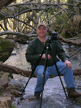
This is a mountain stream that I crossed on the way to the fall.
This road leads into the Haw Creek Campground. The heavy rains raised Haw Creek and covered the road trapping some of the campers. This guy seemed to be comtemplating whether or not to give it a try. I left before he made his decision but I sure hope he turned around.
April showers bring waterfalls. I had plans this particular weekend to do some much overdue yard work. Well, mother nature had other ideas. With the cloudy and rainy weather I had to modify my plans. I sure was disappointed...not. I contacted my friend Steve and we met Saturday morning at 7:30 and hit the road. We traveled through several Arkansas counties, visited 4 waterfalls, drove in pea soup thick fog, hiked in a thunderstorm, had lunch at the "Point of View" restaurant in Jasper (only because the Ozark Cafe was standing room only), and drove over 300 miles. Our day ended at 8:20 p.m. We were both exhausted but it was worth every minute. I hope you enjoy viewing the pictures as much as I did taking them.
High Bank Twins at low water. This obviously is only one of the two. It is located off of Hwy 215 in Franklin County. It is 71' tall.
This is a cascade that we crossed on the way to the Twins. It has no name that I am aware of. Since I was with my wife when I first came here, I call it Melissa falls.
The top of the Glory Hole waterfall in Newton county. The water has drilled a hole in the overhanging bluff creating a very unique waterfall underneath.
The Glory Hole waterfall. This is where the water in the above picture comes out. People often mistake this as light coming from the hole. This fall is 31' tall.
Falling Water Falls in Pope county. This waterfall is 10' tall.
Another view of Falling Water falls. This area is also a popular swimming hole. Notice the ladder on the tree in the background.
Six Finger falls in Pope county. This waterfall is located about six miles past Falling Water on the same road. This waterfall is 6' tall.
Another view of Six Finger falls
Water dripping from moss down stream from Six Finger falls.
I have always liked this type of photograph. It is rushing water downstream from Six Finger falls. This just looks like art to me.
.jpg)
.jpg)
.jpg)
.jpg)
.jpg)
.jpg)


